July 21, 2014
A long-running dispute between local fishing and kayaking enthusiasts and the South Burnett Regional Council will be re-examined in September this year.
The Nanango Tourism and Development Association (NaTDA) has thrown its weight behind a campaign by local watersports enthusiasts to have McCauley Weir re-opened to the public.
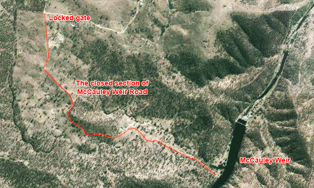
The weir – the site of Nanango’s first water treatment plant – straddles Cooyar Creek south of the town.
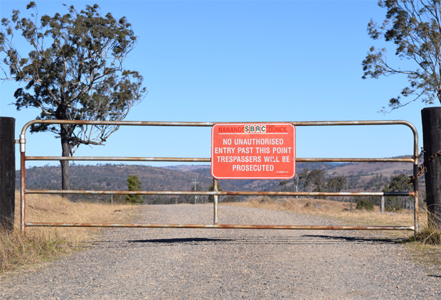
But an unsealed road which provides access to the weir has been locked for almost a decade, blocking public access to the site.
In March 2012 the South Burnett Regional Council voted that McCauley Weir Road would remain closed until further notice because the road was too dangerous and there was no money in Council’s roads budget to carry out repairs.
Last August, after a petition was presented to the council by local watersports groups, Mayor Wayne Kratzmann affirmed nothing had changed since the March 2012 decision.
He said Council had no money in its 2013-14 Budget to do the necessary repairs, and the road was a low priority when set against other shire roadworks.
He said he had driven along McCauley Weir Road himself and could vouch it was dangerous from personal experience.
He was also concerned the old Council water treatment plant located along the road needed to be decommissioned.
Mayor Kratzmann said he could understand some locals wanted the road re-opened, and would ask Council officers to prepare a full update on safety and legal issues surrounding the road and report back.
In May, NaTDA wrote to the South Burnett Regional Council to request the road be re-opened.
The group said they felt the weir area could become a recreational and tourist asset for the town, and thought it was inappropriate to have a public road closed for so long.
At its July meeting last week, NaTDA members were told the Council had responded to their letter to advise the matter would be looked at when Council’s roadworks committee met in September.
NaTDA president Gloria Kirkness said the group would wait for the roadworks committee to re-examine the issue but hoped the matter could be progressed.
- Related article: Road To Stay Closed … For Time Being






I agree with NATDA, I have seen roads around here in worse conditions than the road around the weir. I think they should at least allow walk-in access so people can see the weir. If they can’t even keep this road to a decent condition why don’t they attempt to boost tourism at places like the Broadwater on Barkers Creek, or even just put a few more signs up to tell people about the weir’s history. I think it would help the tourism by demolishing the gates and replacing them with a cattle grid. I think they should get some volunteers down there to build fences and fix the road.
If the road is dangerous, then why are the local residents allowed to drive over it?
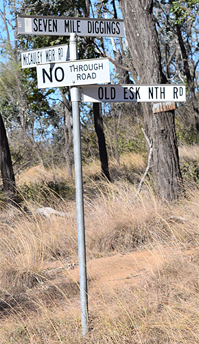
I agree with Mark, if the road is in such a terrible condition, why are the residents and companies such as Ergon Energy and the Fisheries allowed down there. And doesn’t Ergon have large bulky line maintenance trucks? If the problem is further down than the houses it can’t be that bad. Why doesn’t the council take some photos of the road or maybe drive down there and take a video. Alternatively you can still access the weir by a short hike/harder walk from 7 Mile Diggings (4WD highly recommended beyond top car park) about a kilometre upstream from the weir.
This weir is too popular for the road to be closed, the roads in 7 Mile Diggings are in terrible condition. The old public track which turns off the main road down to the actual diggings is too rough and probably beyond repair. The other way is accessable only to those who have 4wd or a good AWD and is falsely signposted that only residents are allowed, this isn’t true as this is the only safe way down to Yarraman Creek. As I mentioned before about the walk it’s a good 2.5 hike from the bottom part of the diggings. I have now walked this and be aware of fence crossings as you can’t leave the creek. McCauleys Weir is huge compared to what it looks like in the air. PS. Carry plenty of water on the walk.
If the weir is not being used, then the wall structure should be demolished. This weir is partly responsible for the demise of fish species in the Cooyar Creek in that it blocks migration of the fish & breaks their breeding cycle.