
January 31, 2019
A new online tool was launched on Thursday to give farmers a single, straightforward place to find out what drought assistance is available to them.
Agriculture Minister David Littleproud said FarmHub brought together the services of the Commonwealth, States, Councils and charities.
“This will tell farmers what assistance is available for them without any mucking around,” Mr Littleproud said.
“Farmers just need to go to farmhub.org.au and type in their location to find help available.
“It will show what fodder, water, transport and living expense assistance is available at an individual farm, as well as mental and physical health services.
“This has all been pulled together and verified by the National Farmers’ Federation.”
* * *
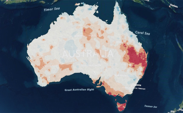
Mr Littleproud also launched a National Drought Map to help co-ordinate the drought response and allow governments, business and communities to make informed decisions.
“The National Drought Map is a clear and precise picture of conditions and the drought response across Australia,” he said.
“This will help us to be flexible and responsive to the drought when conditions change.
“It has information such as rainfall, soil moisture, available government assistance, numbers of farm businesses, agricultural regions and employment by industries.”
External links: