February 11, 2020
Toowoomba Regional Council’s Planning and Development Committee has recommended Council adopt a Planning Scheme amendment which could affect some property valuations in Yarraman and Cooyar, as well as five other “high flood risk” towns in the region.
The amendment identifies which land uses and which types of development require development approval and the standards that new developments must meet.
It was undertaken after the preparation of flood studies and community consultation over the past five years.
The Committee recommendation will be considered for adoption at next Tuesday’s (February 18) Ordinary Meeting of Council.
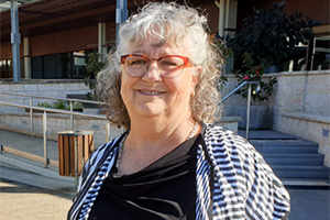
Cr Anne Glasheen said the committee’s recommendations enabled Council to use provisions in the Planning Act 2016 that exempt Council from potential claims for compensation in relation to the new development controls.
“These compensation provisions relate to the seven high-flood risk towns of Cooyar, Crows Nest, Jondaryan, Maclagan, Oakey, Quinalow and Yarraman, which account for 2366 of the region’s 24,000 properties with a flood risk,” Cr Glasheen said.
“The Planning Act 2016 states that where a change to the planning scheme is to reduce the risk of serious harm to people or property from natural events, including flooding, and the planning scheme amendment has been undertaken in accordance with the Minister’s Rules, it is not an adverse planning change and therefore not subject to the compensation provision of the Planning Act 2016.”
The TRC says many of the affected properties are in a zone where a development application would be unlikely, for example community facilities or rural zone.
Of the 2366 properties affected by the exemption, 15 submissions were lodged with Council in relation to the proposed compensation exemption.
“Council has used best practice methodology and the best available information to identify the areas subject to flooding within our region,” Cr Glasheen said.
“The Planning Act’s compensation provisions do not include consideration of reduced property values, higher insurance prices and reduced saleability.
“In relation to decreased property values, the Real Estate Institute of Queensland has advised that flood-related impacts on property value and sales relate more to actual flood events than to the designation of flood risk by Council.
“Council has a duty of care to the community and a responsibility to identify and respond to flood risks within our region.
“When Council adopted the planning scheme in 2012, the State Minister included a condition that Council take immediate steps to improve the coverage of flood risk mapping and controls across the region.
“More accurate flood mapping offers a better understanding of a location’s vulnerability to flooding.
“It helps to raise awareness about flooding and flood risks around the region for residents and policy makers at the State and local levels of government.
“A greater level of detail in the mapping means insurers can locate individual properties more accurately on flood risk maps and rate premiums accordingly.
“Council will continue to modify the Regional Planning Scheme to facilitate flood studies and hazard studies in line with statutory requirements.”
Related articles:
- Council Seeks Feedback On Flood Planning
- Toowoomba Wants Flood Risk Feedback
- Meetings To Discuss Flood Risks
- Last Chance To Comment On Flood Studies
- Toowoomba Council Releases Flood Maps
[UPDATED]


