February 25, 2015
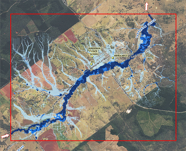
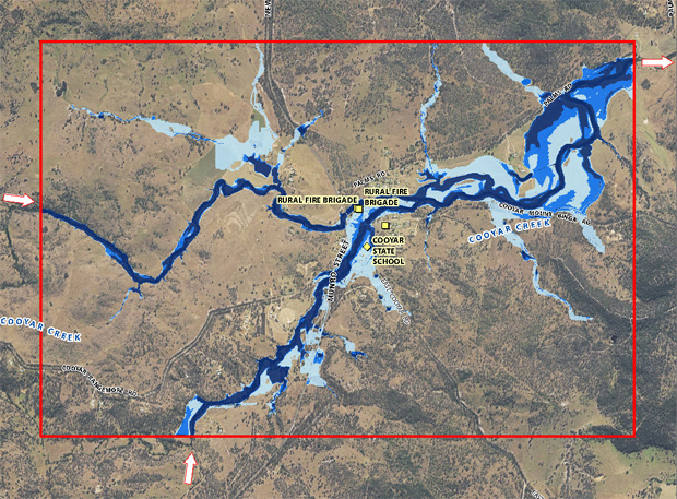
Toowoomba Regional Council today released the results of flood studies for towns throughout the region, including Cooyar and Yarraman.
The studies form part of Council’s commitment to improve flood management and community awareness of flood risk.
The studies have been prepared by specialist engineers and incorporate the latest data, modelling techniques and community input and have all been peer-reviewed by independent flood engineers.
* * *
Feedback From Community
Toowoomba Mayor Paul Antonio said the Queensland Floods Commission Inquiry clearly stated in its 2012 final report that Councils had a responsibility to minimise future damage.
“These studies were the result of a legislative requirement, but Toowoomba Regional Council is taking it a step further to embed lessons learnt and improve decision-making across all Council activities,” he said.
“No other local government in Australia has embarked on a region-wide flood management project of this scale and in this short a period of time.”
He said Council recognised the need for the whole community to be involved in the initiative.
“Consequently, consultation sessions will be held across the region including a dedicated webpage to give opportunities for all community members to participate and provide feedback on the flood studies.”
He encouraged communities from across the region to get involved in the process.
- In Yarraman, Council will hold a public meeting at Memorial Hall on March 18 from 3:00pm-7:00pm.
The TRC has also established a dedicated webpage which provides the full studies, flood maps, location specific information sheets, frequently asked questions and the consultation schedule.
* * *
Flood Data Given To Insurers
Insurance Council of Australia chief executive officer Rob Whelan said the Toowoomba Regional Council’s flood data was among the highest quality available in Australia.
“Highly accurate flood data helps local governments make appropriate planning decisions in areas exposed to extreme weather and natural hazards,” Mr Whelan said.
“The ICA is pleased Council has given insurers access to this data, which will help companies assess risk when offering insurance policies to local residents.
“The insurance industry encourages all local councils to follow Toowoomba Regional Council’s lead in this area and provide their flood data to insurers through the ICA.”


