April 7, 2015
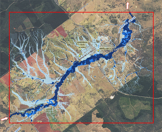
Yarraman and Cooyar residents have until Friday (April 10) to lodge online comments or information to be considered as part of Toowoomba Regional Council’s flood resilience project.
Details can be lodged via the project webpage.
Toowoomba Region Mayor Paul Antonio said Council thanked every participant for attending the public sessions which have been held around the region.
He said the public forums had been one of the largest community engagements Council had undertaken.
“Following the 2010 and 2011 floods, Council has not only been rebuilding public infrastructure, but giving a high priority to examining flood information to inform extensive disaster preparedness and planning documents,” Mayor Antonio said.
“Council rightly invested funds and time to allow specialist engineers to formulate some of the most comprehensive flood studies completed in Australia.
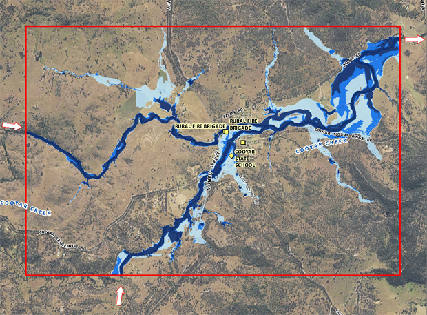
“This work resulted in detailed flood studies being compiled for 35 locations across the Toowoomba region. We want the best information possible to better inform people about the likelihood of future flooding.
“On top of this work, it was important to hear residents’ personal accounts and stories from their flood experiences over the years.
“We have been overwhelmed by the keen interest people have shown at all the public sessions. This is greatly appreciated and relevant information will form a key addition to the studies.
“There have been more than 2000 personal and online interactions to date.
“This is a topic which concerns and affects many people and Council’s aim is to use evidence-based information to make better planning decisions across the region.
“Some people had video footage or scrapbooks with recent and historical clippings of flood events.
“Council also wishes to thank the community advocates who have assisted Council’s staff and been busy spreading the word about the project in their respective communities.
“Their enthusiasm and local knowledge ensured the public forums were well attended and were a rich source of historical information.
“This will ensure we have a broad and extensive overview of data to better safeguard communities.”
Information from the public sessions will be used to update flood maps where necessary.
Each location’s vulnerability to flooding, together with the community’s awareness and experience with floods, will help with the assessment of the flood risk faced there.
Further consultation sessions will be held with targeted communities later in the year to discuss the flood risk and the possible flood management options.
- Related article: Toowoomba Council Releases Flood Maps
