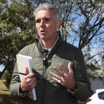
(Photo: Grant Newson)

July 16, 2013
Greens candidate for Maranoa Grant Newson is concerned that areas which have been clear-felled inside the boundaries of the Bunya Mountains National Park could be earmarked for future development.
Mr Newson has posted screenshots taken from Google Earth on his Facebook page which show forested areas that have been logged inside the park since 2006.
He is concerned that logging has been allowed inside a National Park but is also worried that there has been no attempt to revegetate the cleared areas, which he says have been left to be overrun with “lantana and feral animals”.
The areas were added to the Bunya Mountains National Park in June 2006 as part of a commitment by the then-State Government to convert 407,000ha of forest in south-east Queensland to protected areas.
At the time, then-Environment Minister Desley Boyle said the additions represented “part of the State’s most significant expansion of national park to date”.
“This means land with some of the highest conservation value and biodiversity in southern Queensland will be converted to national park or another form of protected land tenure,” Ms Boyle said in a media release (11.6kb PDF).
Mr Newson said that as well as being left to be over-run with lantana, there had also been issues caused by run-off from the logged areas and the whole National Park area had been left more vulnerable to bushfires.
The area that Mr Newson has highlighted is located on the eastern foothills of the mountains near the end of Upper Barker Creek Road.
On December 6, 2011, southburnett.biz reported Mr Newson’s concerns that logging was taking place inside the National Park in the vicinity of Barkers Creek and Middle Creek.
“There is absolutely no way (areas) inside any National Park area should be allowed to be harvested,” he said at the time.
Mr Newson said today “flood recovery” money had been spent repairing the access roads to the logging area and replacing culverts, although no one lived in the vicinity.
He could not understand why this had occurred unless logging trucks were still using the roads or unless some sort of development or sub-division was planned in the logged areas.
* * *
Member for Nanango Deb Frecklington said the photographs posted online by Mr Newson showed areas that were formerly State Forest which contained hoop pine plantations.
“These plantations were harvested by Hancock Queensland Plantations under a conservation hand-back program in collaboration with the Queensland Parks and Wildlife Service under the Regeneration Plan for Bunya Mountains National Park (Recovery),” she said.
“Harvesting was completed and the area was formally accepted by QPWS in late 2011 for ongoing management as National Park (Recovery).”
Questioned about areas being left to be over-run with lantana, Mrs Frecklington replied:
“Queensland Parks and Wildlife Service has established a monitoring program for the Recovery area which will focus on changes to the structural and floristic characteristics of the rainforest and woodlands over time,” she said.
“They are working co-operatively with neighbours, local governments and the broader community to reduce the impacts of lantana on neighbouring land and the estate.
“Currently, the management aim for lantana control is to reduce the extent, concentrating initially on firelines / tracks / ecologically sensitive areas where herbicide treatment will be most effective.
“Broad-scale control programs using herbicides are not considered a viable long-term option, however the use of biological control measures is also being investigated.”
* * *
The expansion of the Bunya Mountains National Park was first mooted in 2004.
South Burnett Online reported at the time: 21st May 2004: The Bunya Mtns National Park will almost double in size by the end of this year, the State Government announced today (10K PDF). The Park will expand to take in the Cooyar and Neumgna Forest Reserves, as well as extra lands adjoining the current boundaries. You can obtain a map of the proposed new Bunya Mtns National Park area as a 114K Adobe PDF by clicking here
There was no mention in any of the media releases that some of the areas to be added to the National Park would still be commercially logged, although a notation on a map marked two spots as “future national park recovery”.