
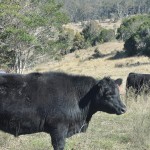
(Photo: AgForce)
June 20, 2019
A change in vegetation mapping introduced by the State Government in a bid to protect habitats for endangered species has alarmed AgForce.
The agricultural lobby group has described the change as “arbitrary” and says it will have a devastating effect on many producers, making it more onerous and expensive to manage and graze their land and potentially driving down property values by millions of dollars.
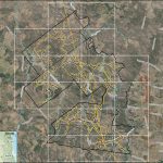
AgForce says the new trigger – or “Blue Dot” – maps have dramatically increased the area thought to support notably Endangered, Vulnerable and Near Threatened species.
However, it says these areas are not “proven”.
The new maps were released recently.
AgForce CEO Michael Guerin said the State Government had placed the administrative and financial onus on to producers.
“There appears to be no available scientific, ecological or cartographic rationale for how these new maps, which in some cases have increased the protected areas on properties from almost nothing to nearly everything, have been developed,” Mr Guerin said.
“As soon as we found out the new maps had been released, we sought meetings with DES and the Queensland Herbarium to understand the methodology behind the massive change and the impact that would have on producers.
“DES staff couldn’t explain the considerable discrepancies in how protected plant areas are mapped, such as why, for example, neighbours with identical agricultural land use have been mapped differently.
“They also had no answers for the extensive errors throughout the maps, such as including dams, mines, quarries and even sporting stadiums as protected plant habitat.
“They promised to investigate and come back to us so we can advise AgForce members, but this is yet to happen.”
Mr Guerin said producers were being forced to do, as well as pay for, the State Government’s work.
“Producers are prevented from clearing or thinning on areas which may be home to protected species,” he said.
“It is up to each producer to commission a formal ecological survey of their property, an operation that costs a minimum of $5000 and anywhere up to $30,000 depending on the size and complexity of the protected area, to determine the accuracy and veracity of the government’s map.
“In other words, the government isn’t sure whether anything worth protecting exists in those locations, and there is even a disclaimer that the ‘government takes no responsibility for the accuracy of this product’.
“Yet, fines for breaching the regulations are anywhere up to $400,000 for a Class 1 offence, so unless producers want to risk this sort of penalty, these surveys are an expensive and unexpected process that must be gone through.”
Mr Guerin said producers wanted to protect endangered species “but were disillusioned by the unscientific and disruptive method the government had decided, without any industry consultation, to adopt”.
“AgForce are currently preparing individual property maps for members to go out at the end of the month,” he said.
“AgForce members should contact AgForce if they would like assistance to understand the new mapping and the implications for their properties.”













Blimey, aren’t we primary producers ever going to get a bit of peace from these loonies, ever please? I’m over it big time!!