May 30, 2017
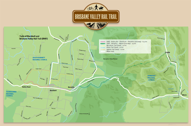
The Department Of Transport and Main Roads has released a collection of section maps for the Brisbane Valley Rail Trail.
The new maps cover all sections that are currently open to the public, except for the section between Brassall and Wanora completed last November, and the remaining incomplete section between Toogoolawah and Moore.
The new maps summarise conditions along each section of the trail, and provide tips about proper conduct when using the Rail Trail and nearby services that might be useful to trail users.
However, a map for the Toogoolawah to Moore section is unlikely to be available in the immediate future.
Last January the State Government announced it would allocate $1.8 million to complete the remaining section of the trail.
But because the section has a number of major creek and road crossings that pose significant engineering challenges, the total cost of the project is expected to be $3.3 million.
Somerset Regional Council has applied to the National Stronger Regions Fund for a $1.45 million contribution to make up the difference.
If the Council is successful, work to complete the missing section is expected to commence this year once a scope of works has been finalised, appropriate approvals put in place, and there has been public consultation with adjoining landowners and the community.
It is expected construction of the 26km section would take approximately 6 months.
The completion of the final section of the BVRT would then connect Wanora (near Ipswich) to Yarraman, a distance of about 168km.
An estimated 14,000 people a year now use the Yarraman to Linville section of the BVRT.
The new section maps are supplied in PDF format and can be downloaded from DMTR’s website
