
March 29, 2017
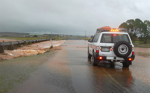
Member for Nanango Deb Frecklington has warned residents to be vigilant over the next few days as the remnants of Cyclone Debbie head our way.
Mrs Frecklington said reports were predicting heavy rainfall in the South Burnett and she was keen to ensure the community stayed safe.
“It is possible we will see extensive rainfall across the region, and as we all know, our creeks and waterways are prone to flooding during these types of events,” she said.
“I would encourage people to stay off the roads if possible, and remember, if it’s flooded, forget it.
“The flooding events in 2011 and 2013 have taught our region much in regards to being prepared and staying out of flooded waters, but I hope things don’t get as bad as they have previously.
“The rain, though will bring much relief for our farmers who have been struggling with such a long dry period and I know many are counting on this weather filling dams and aquifers.”
- Related article: South Burnett Braces For Heavy Rain
* * *
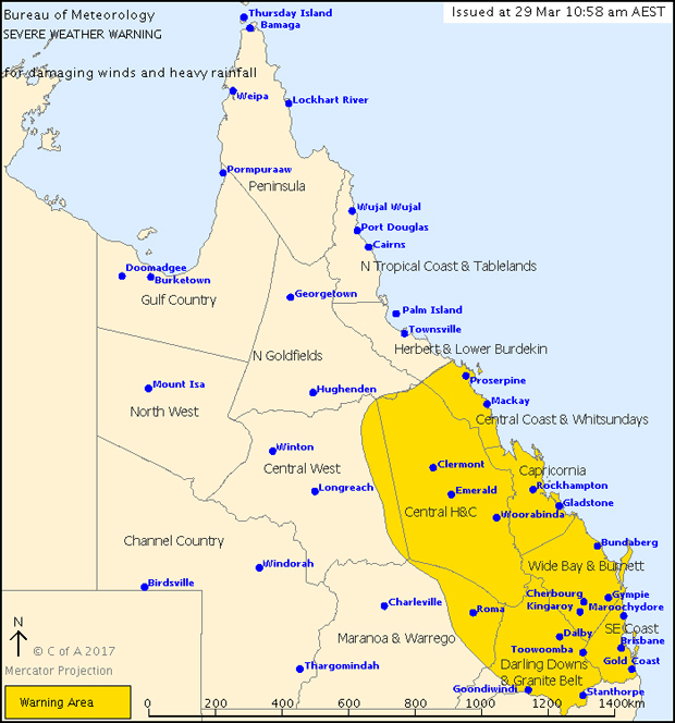
The Bureau of Meteorology issued a severe weather warning for damaging winds and heavy rainfall for much of south-east Queensland – including the South Burnett – on Wednesday morning:
For people in the Central Coast and Whitsundays, Central Highlands and Coalfields, Capricornia, Wide Bay and Burnett, Darling Downs and Granite Belt, Southeast Coast and parts of the Central West and Maranoa and Warrego Forecast Districts:
Heavy rain and damaging wind gusts are currently affecting the Central Coast and Whitsundays and Central Highlands and Coalfields districts, slowly extending southwards.
At 11:00am EST Ex-Tropical Cyclone Debbie was located over inland central Queensland about 130km west-northwest of Moranbah. The system is expected to continue moving southwards over the central interior of the State today (Wednesday) before tracking southeastwards during Thursday.
Ex-Tropical Cyclone Debbie will continue to generate areas of very heavy rain over the Central Coast and Whitsundays and Central Highlands and Coalfields districts today (Wednesday).
Widespread daily rainfall totals of 150 to 250 mm are expected, with significantly higher totals possible locally. This rainfall will likely be very intense at times, leading to a risk of localised flash flooding. Locations that may be affected (on Wednesday) include Mackay, Sarina, Carmila, Yeppoon, Moranbah, Clermont, Emerald, Springsure and Rolleston.
The focus for heavy rain will then shift south and extend into the southeastern quarter of the State during Thursday, with further daily rainfall totals in excess of 200mm possible.
This rainfall is likely to lead to major river flooding over a broad area this week, and a Flood Watch is current for coastal catchments between Ayr and the NSW border, extending inland to parts of the Central Highlands and Coalfields, Central West, Maranoa and Warrego, and Darling Downs and Granite Belt forecast districts.
Damaging winds, with peak gusts of around 100km/h, are occurring in the warning area, particularly about the coast and islands and also over higher ground inland. Currently the strongest wind gusts are affecting areas north of about Emerald to St Lawrence though the possibility of damaging wind gusts should shift to the remaining warning area as Ex-Tropical Cyclone Debbie tracks south southeastwards tonight (Wednesday night).
Into Thursday the focus for damaging wind gusts will likely shift to the Capricornia coast and then possibly to the remaining coast near and south of Fraser Island during Thursday afternoon and evening.
- Related article: Council Updates Weather Alert


