February 18, 2015
[UPDATED 11:45pm]
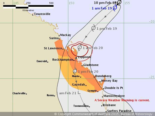
The South Burnett could get between 100-150mm rain on Friday when Tropical Cyclone Marcia crosses the coast.
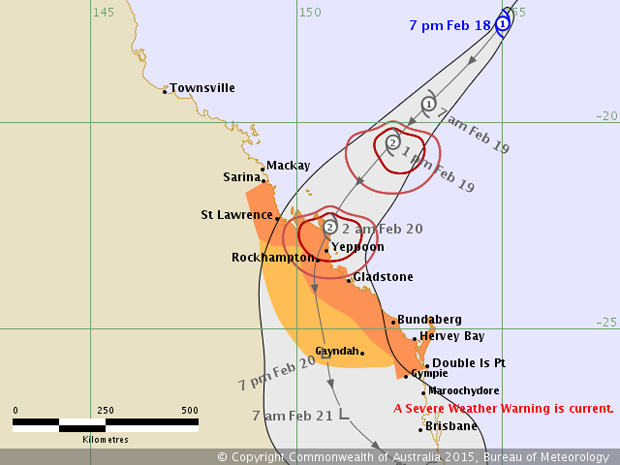
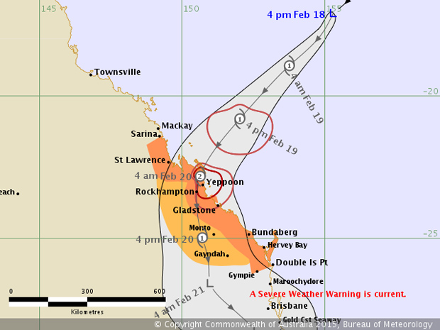
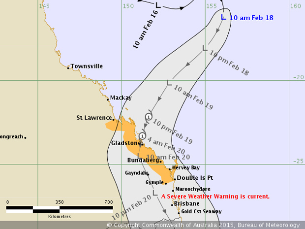
The low pressure system which has been tracking towards the Queensland coast all day officially developed into a Category 1 cyclone about 7:00pm.
Earlier today, it was moving at just 11km/h but as the day progressed it picked up speed to 22km/h and began to slowly grow in intensity.
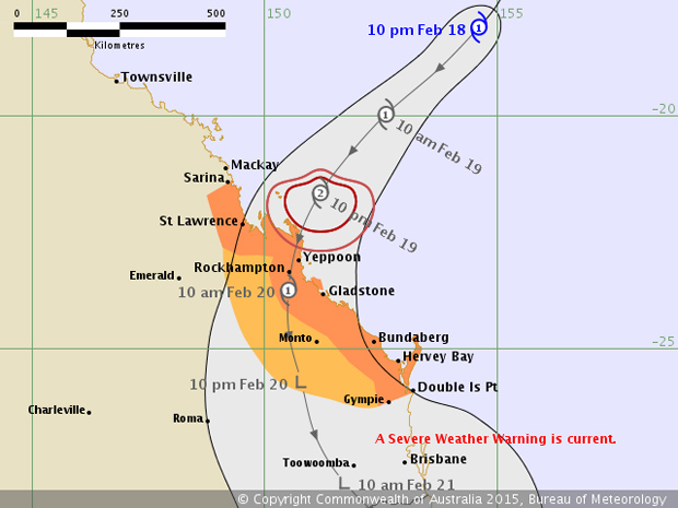
TC Marcia is expected to continue to strengthen into a Category 2 cyclone before it crosses the coast, north of Yeppoon, about 2:00am on Friday.
Currently there are sustained winds of 65km/h near the centre with wind gusts to 95km/h.
A trough extending south from the cyclone will start affecting the Capricornia, Wide Bay and south-east Queensland coasts on Thursday, with storms and strong wind gusts.
Heavy rain may lead to flash flooding, with some 24-hour totals in excess of 300mm tipped in coastal areas.
It is not known how far inland this rain band will extend however a flood watch is current for the Capricornia, Wide Bay and Burnett, Southeast Coast and Darling Downs districts.
At 3:00pm this afternoon, South Burnett Mayor Wayne Kratzmann, who is chairman of the South Burnett Region Disaster Management Committee, and Disaster Management Coordinator Stan Taylor attended a Tropical Cyclone Weather Teleconference Briefing conducted by the State Disaster Coordination Centre.
Once the cyclone has crossed the coast, the South Burnett region could expect rainfall of 100 to 150mm within a 24-hour period.
Rainfall of this significance is likely to cause localised river and flash flooding.
It is anticipated the rain will start to clear on Saturday with Sunday having fine weather.
* * *
Issued 1:00am Thursday:
Issued 11:00pm today:
Issued 8:04pm today:
Issued 5:08pm today:
Issued 11:18am today:
* * *
The Queensland Fire and Emergency Services (QFES) has urged Queenslanders living between Rockhampton and the border to “Get Ready” for heavy rainfall in coming days.
“Check your house, in particular the roof, is in good condition, keep branches clear of the house, clean gutters and clear your property of debris,” QFES Deputy Commissioner Mark Roche said.
“Also ensure your emergency kit is well stocked with essential items and is kept close by.
“If you live in an area which could be impacted by localised flooding, move vehicles, outdoor equipment, indoor items, garbage, chemicals and poisons to higher locations.”
Mr Roche said the heavy rainfall could result in the flooding of creeks, drains and causeways.
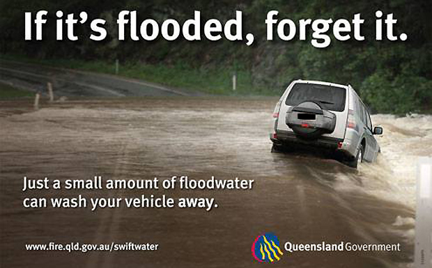
“The simple and constant message here is: if it’s flooded, forget it,” he said.
“Under no circumstance should you enter floodwaters by road or on foot. If you come across a flooded road, turn around and seek an alternative route.
“Parents, supervise your children closely and discourage them from playing or swimming in flooded creeks or drains.
“Floodwater could mask hidden dangers such as storm debris, eroded areas that are deeper than they appear, or strong currents.”
Mr Roche reminded residents to keep in mind that State Emergency Service (SES) volunteers responded to hundreds of requests during storms and asked that those requiring assistance be patient.
“Most SES tasks are not quick jobs, and often extensive work and time is required to attend to storm damage,” he said.
For storm and flood emergency assistance contact the SES on 13-25-00 and in a life-threatening emergency dial Triple Zero (000).
The Get Ready guidelines are available online
[Published earlier as “Tropical Low Heading For Coast”]


