September 19, 2012
There’s been some dire predictions recently about a hellish bushfire season ahead of us … but not if the local rural fire brigades can help it.
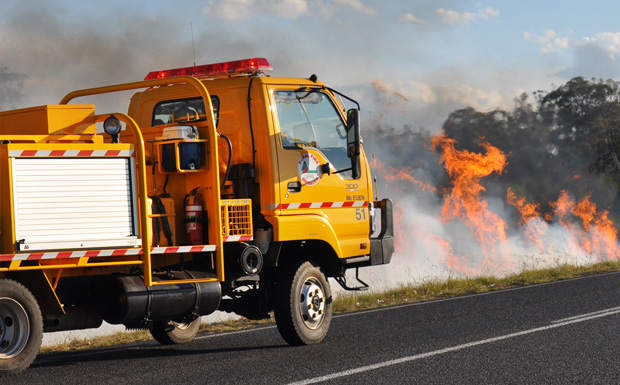
Crews have been spotted all over the South Burnett in recent few weeks doing controlled burns.
One of the latest occurred yesterday afternoon when rural firefighters from Ballogie and Mt McEuen burned off overgrown land alongside the Bunya Highway between Tingoora and Wondai.
There’s been numerous other controlled burns, including at Booie, Brooklands, Gordonbrook, Goodger, Murgon and Nanango.
So how bad is this summer going to be?
Last week, the Rural Fire Brigades Association of Queensland said this could be “the worst bushfire season in 50 years”.
And the Bushfire Co-Operative Research Centre is worried about fuel loads throughout most of Queensland. It has also predicted an early start to the bushfire season. According to their report released late last month:
Current grass fuel levels throughout Queensland are considered abundant and continuous.
Although Queensland has experienced slightly wetter than normal early winter conditions, August to date has seen below average rainfall and cooler temperatures with extensive frosts, especially in the western and central western parts of Queensland.
This contributed to a rapid increase in grassland curing, and general vegetation conditions in the south-west of the state may indicate an early start to the bushfire season over a wide area.
Fast running, high intensity grass fires can be expected over most of the state.
There are particular concerns for large grass fires in southern and western Queensland.
How Great Is The Risk Of Fire In The South Burnett?
The region has already seen a number of grass fires erupt accidentally this year. There’s been a host of small to medium grassfires, including fires at Nanango, Brooklands, Maidenwell, Cushnie, Murgon, Memerambi and Alice Creek. Fortunately all have been brought under control rapidly by rural and town brigades.
Modelling of the South Burnett region shows most of the area classified as “medium” or “low” risk. It should be noted that this was completed four years ago by the Rural Fire Service and the Queensland Fire and Rescue Service, well before the current build-up of fuel.
However even this assessment shows there are pockets of high risk, including around Maidenwell, the foothills of the Bunya Mountains, Brooklands, Malar, north of Benarkin, Bullcamp, Allies Creek, Windera, Booubyjan and north of Stonelands.
- Download the Rural Fire Service’s risk map for the South Burnett (893kb PDF)
Bushfire Survival Plan
So it’s time that we got prepared. Do you have a Bushfire Survival Plan? The Rural Fire Service says this is essential …
The survival plan should detail how you would prepare and what action you would take if threatened by a bushfire.
They say a well-prepared home has an increased chance of survival in a bushfire.
The plan must be written down and practised and should take into consideration the ages and physical capabilities of everyone in the household, including children and elderly residents.
On days of catastrophic and extreme fire weather, the QFRS advises that people leave the area well in advance of any fire (the night before or early in the morning is recommended).
- Download a copy of the QFS Bushfire Survival Booklet here (1.7Mb PDF)
Emergency Warnings
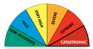
Did you know Queensland has adopted the new national Fire Danger Rating Index?
This includes two new levels of “severe” and “catastrophic”.
There are three types of alert messages – “Advice”, “Watch and Act”, and “Emergency Warnings”.
- “Advice” messages keep people informed and up-to-date with developments on a fire.
- “Watch and Act” messages advise people to take action to prepare and protect themselves.
- “Emergency Warnings”, accompanied by a siren sound effect on TV and radio, advise that you must take action immediately as you will be impacted by the fire.


